About
1. Content
The MEDEA-CHART Database is a free-of-charge online information system dedicated to old nautical charts, created under the European Research Council project MEDEA-CHART. The system holds digital images and information about medieval and early modern manuscript nautical charts and atlases from c. 1270 (the date of the Carte Pisane, the earliest extant nautical chart) onward. In complement to manuscript charts, the system also holds:
- All known Portuguese cartographic production up to the end of the 18th century, most of which was covered by Portugaliae Monumenta Cartographica (Armando Cortesão & Teixeira da Mota, 1960; 1987). This includes not only manuscript nautical charts but also printed charts, plans of ports, coastal views, and related drawings;
- Printed charts of special historical significance, such as Mercator’s world chart of 1569 and Martin Waldseemüller’s world maps;
- Some medieval and early modern maps of particular importance, such as the Tabula Peutengeriana (c.1300), the Tabula Rogeriana (1553), and Fra Mauro’s map (1459).
As of April 2024, the database contains approximately 6400 charts (of which about 4400 are part of atlases), 670 atlases, 500 authors and 415 archives. About 80% of the charts have associated digital reproductions, some of them in high resolution. The database is continuously growing, with ongoing incorporation of newly-discovered charts and the addition of more and better images. Although most of the extant manuscript nautical charts and atlases of the period covered by the database are kept in public archives, a significant number are in private hands, some of whose whereabouts remain unknown. Sporadically, a hitherto unknown exemplar is found and brought to the attention of historians, after which it is promptly incorporated into the database. But since these occurrences are infrequent, it is safe to assume that a vast majority of all extant manuscript nautical charts and atlases have been identified and are now covered by the database.
An important feature of the database is its connection with Richard Pflederer’s ‘Census of Charts and Atlases’, on which system’s information is largely based.
2. Structure
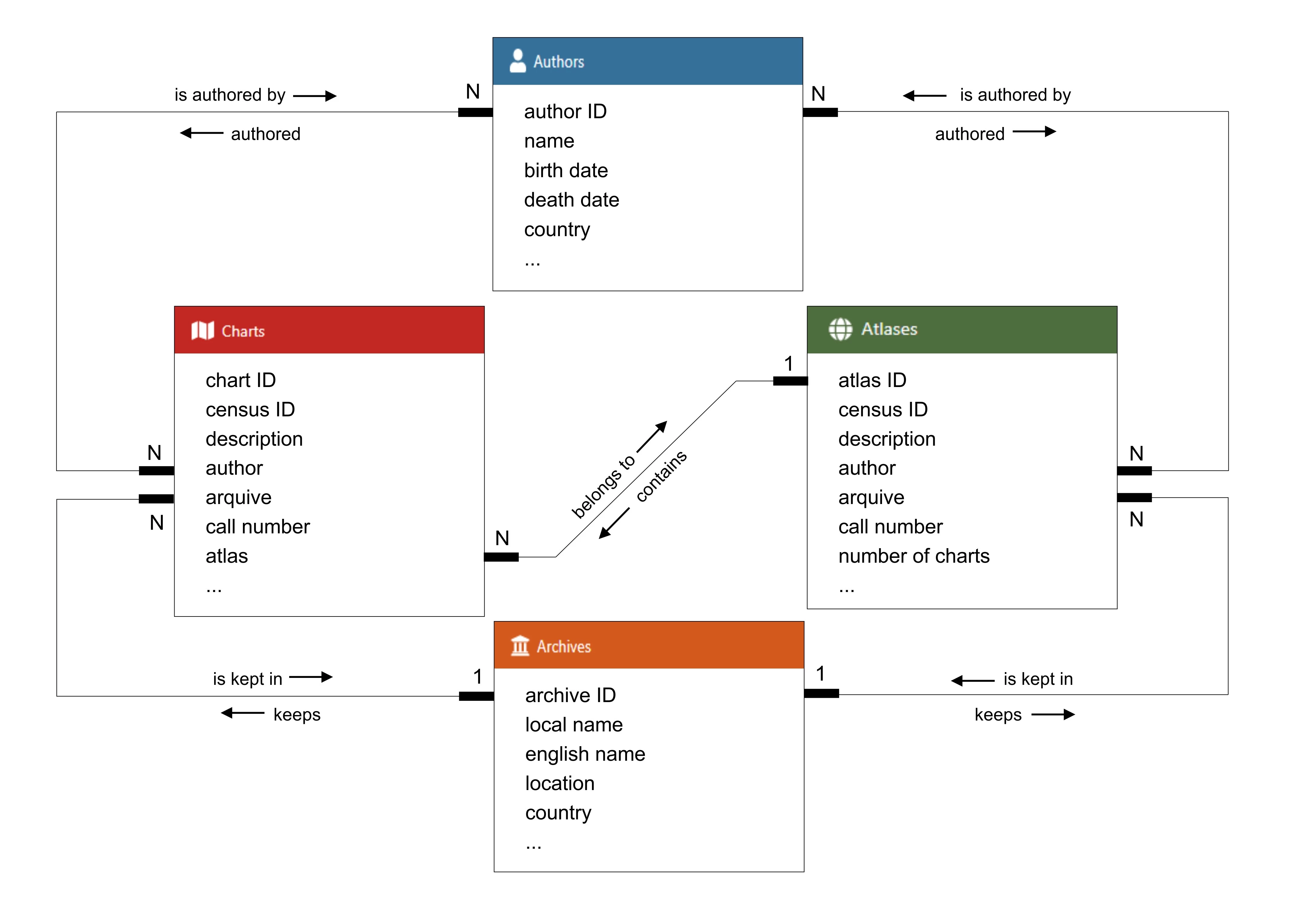
The MEDEA-CHART database is organized into four main categories: Charts, Atlases, Authors and Archives. These categories represent the focus of the content available throughout the system, and all of them have multiple associated records. Each record is described by a set of attributes that uniquely characterize it. For charts, some examples of these attributes are a unique identifier, a common name, and a production date. Categories are connected to each other by their shared attributes (for instance, charts and atlases may have one or more associated authors, or archives may store multiple charts and atlases). While browsing the system, the user is presented with a link when data overlaps with another category. A simplified graphical representation of the database structure, identifying some of the attributes and relations, is shown below.